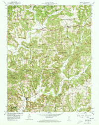
1957 Map of Bristow
USGS Topo · Published 1973About this map
The Indian Treaty Boundary cuts a diagonal line across this southern Indiana landscape, marking a historical division that still influenced property lines and road orientations when this survey was field-checked in 1957. The terrain is defined by the winding course of the Anderson River and its numerous tributaries, including Sigler Creek and Winding Branch. Settlements like Siberia, Bristow, and Uniontown serve as small hubs within a region heavily dominated by the Ferdinand State Forest and Hoosier National Forest.
Find a feature on this map
37 named features on this map. Tap any name to fly to it.
Don’t see what you’re looking for? This feature index may not catch every label — zoom into the map to look around manually.
Map Details
Editions of this 1957 Bristow Map
4 editions found
Other maps of this area

1900 · St Meinrad
USGS Topo · 1:62,500

1903 · St. Meinrad
USGS Topo · 1:62,500

1954 · Derby
USGS Topo · 1:24,000

1955 · Saint Anthony
USGS Topo · 1:24,000

1956 · Taswell
USGS Topo · 1:24,000

1956 · Vincennes
USGS Topo · 1:250,000

1957 · Vincennes
USGS Topo · 1:250,000

1957 · Birdseye
USGS Topo · 1:24,000
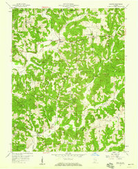
1957 · Bristow
USGS Topo · 1:24,000

1958 · Vincennes
USGS Topo · 1:250,000