
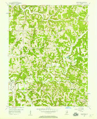
1956 Map of Greenbrier
USGS Topo · Published 1957About this map
Patoka River meanders across this mid-century survey of the Orange and Crawford County borderlands, a landscape defined by deeply dissected drainage systems and rural outposts. Within the boundaries of the Hoosier National Forest, the small settlement of Newton Stewart serves as a western anchor, while Greenbrier sits centrally along the winding township roads. The map reveals a dense network of local landmarks essential for genealogical research, including multiple country churches like South Liberty Ch and McDonald Ch, alongside schoolhouses such as Flick Sch and Ethel Sch. The terrain is punctuated by significant elevations like Tillery Hill and the Spears Lookout Tower, offering a detailed view of the forest before modern development altered these rural corridors. Waterways such as Lick Creek and Youngs Creek carve through the townships of French Lick and Jackson, illustrating the complex natural topography of southern Indiana.
Find a feature on this map
34 named features on this map. Tap any name to fly to it.
Don’t see what you’re looking for? This feature index may not catch every label — zoom into the map to look around manually.
Map Details
Editions of this 1956 Greenbrier Map
2 editions found
Other maps of this area

1950 · Valeene
USGS Topo · 1:24,000

1950 · English
USGS Topo · 1:24,000

1951 · Hillham
USGS Topo · 1:24,000

1951 · French Lick
USGS Topo · 1:24,000

1956 · Taswell
USGS Topo · 1:24,000

1956 · Vincennes
USGS Topo · 1:250,000

1957 · Vincennes
USGS Topo · 1:250,000

1957 · Cuzco
USGS Topo · 1:24,000
1957 · Paoli
USGS Topo · 1:24,000

1957 · Birdseye
USGS Topo · 1:24,000