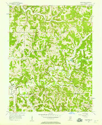
1956 Map of Greenbrier
USGS Topo · Published 1970About this map
The Patoka River meanders through the heart of the Hoosier National Forest in this mid-century survey of southern Indiana. The landscape is defined by the winding drainages of French Lick Creek, Painter Creek, and Fleming Creek, which carve through the wooded terrain near the Orange and Crawford County line. Small rural settlements like Newton Stewart and Greenbrier serve as local hubs, anchored by a network of country churches including South Liberty Ch, McDonald Ch, and Patoka Ch.
Find a feature on this map
28 named features on this map. Tap any name to fly to it.
Don’t see what you’re looking for? This feature index may not catch every label — zoom into the map to look around manually.
Map Details
Editions of this 1956 Greenbrier Map
2 editions found
Other maps of this area

1950 · Valeene
USGS Topo · 1:24,000

1950 · English
USGS Topo · 1:24,000

1951 · Hillham
USGS Topo · 1:24,000

1951 · French Lick
USGS Topo · 1:24,000

1956 · Greenbrier
USGS Topo · 1:24,000

1956 · Taswell
USGS Topo · 1:24,000

1956 · Vincennes
USGS Topo · 1:250,000

1957 · Vincennes
USGS Topo · 1:250,000

1957 · Cuzco
USGS Topo · 1:24,000
1957 · Paoli
USGS Topo · 1:24,000