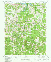
1980 Map of Birdseye
USGS Topo · Published 1981About this map
The town of Birdseye serves as a central hub for this portion of southern Indiana, situated along the Southern railroad line. The landscape is defined by the expansive Ferdinand State Forest and Hoosier National Forest, which dominate much of the topography with their dense timber and winding hollows. In the north, the waters of Patoka Lake reach into the terrain at Lick Fork, where a Boat Ramp provides access to the reservoir. Smaller settlements like Schnellville and Riceville are connected by local routes such as Schnellville Road, while the southern reaches of the map transitions into the more industrial character of Oil township, marked by several Oil Wells. Local history is preserved in numerous family cemeteries scattered across the ridges, including Blunk Cem and Sigler Cem, reflecting the deep-rooted rural communities of Dubois and Crawford counties.
Find a feature on this map
48 named features on this map. Tap any name to fly to it.
Don’t see what you’re looking for? This feature index may not catch every label — zoom into the map to look around manually.
Map Details
Editions of this 1980 Birdseye Map
This is the sole edition of this map. No revisions or reprints were ever made.
Other maps of this area

1900 · St Meinrad
USGS Topo · 1:62,500

1903 · St. Meinrad
USGS Topo · 1:62,500

1954 · Dubois
USGS Topo · 1:24,000

1955 · Saint Anthony
USGS Topo · 1:24,000

1956 · Greenbrier
USGS Topo · 1:24,000

1956 · Taswell
USGS Topo · 1:24,000

1956 · Vincennes
USGS Topo · 1:250,000

1957 · Vincennes
USGS Topo · 1:250,000

1957 · Cuzco
USGS Topo · 1:24,000

1957 · Birdseye
USGS Topo · 1:24,000