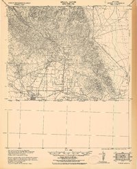
1933 Map of Bisbee
USGS Topo · Published 1933About this map
Copper mining operations and railroad corridors dominate this 1933 tactical survey of the Arizona-Sonora borderlands. The high-altitude activity centered around Bisbee is depicted in detail, with residential and industrial pockets like Lowell, Bakersfield, and Tin Town crowding the base of the Mule Mountains. These mining camps and towns are connected by the Borderland Route U.S. Highway No. 80, winding through Black Gap and toward the east.
Find a feature on this map
56 named features on this map. Tap any name to fly to it.
Don’t see what you’re looking for? This feature index may not catch every label — zoom into the map to look around manually.
Map Details
Editions of this 1933 Bisbee Map
This is the sole edition of this map. No revisions or reprints were ever made.
Other maps of this area

1902 · Bisbee
USGS Topo · 1:62,500

1910 · Bisbee
USGS Topo · 1:62,500

1914 · Hereford
USGS Topo · 1:125,000

1914 · Douglas
USGS Topo · 1:62,500

1915 · Benson
USGS Topo · 1:125,000

1916 · Pearce
USGS Topo · 1:125,000

1916 · Douglas
USGS Topo · 1:125,000

1919 · Douglas
USGS Topo · 1:125,000

1922 · Swisshelm
USGS Topo · 1:62,500

1925 · Douglas
USGS Topo · 1:62,500