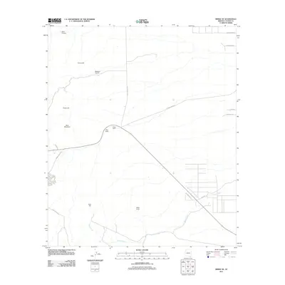
2011 Map of Bisbee NE
USGS Topo · Published 2011About this map
The Mule Mountains dominate the western portion of this Cochise County landscape, where deep drainages like Dixie Canyon and Mexican Canyon cut through the high desert terrain. Near the center of the sheet, Forrest Ranch sits alongside Mule Gulch, marking a point of human habitation in an area defined by its dramatic topography. The eastern plains transition into more organized residential pockets, notably Littleton, which is serviced by a network of rural roads such as W Double Adobe Rd and High Lonesome Rd. Prominent landmarks including Gold Hill and Black Knob serve as natural navigational points for those tracing the historical footprint of ranching and early travel routes. The course of Glance Creek winds through the southern reaches, highlighting the vital role of seasonal waterways in this arid environment.
Find a feature on this map
22 named features on this map. Tap any name to fly to it.
Don’t see what you’re looking for? This feature index may not catch every label — zoom into the map to look around manually.
Map Details
Editions of this 2011 Bisbee NE Map
This is the sole edition of this map. No revisions or reprints were ever made.
Other maps of this area

1902 · Bisbee
USGS Topo · 1:62,500

1910 · Bisbee
USGS Topo · 1:62,500

1914 · Douglas
USGS Topo · 1:62,500

1916 · Pearce
USGS Topo · 1:125,000

1916 · Douglas
USGS Topo · 1:125,000

1919 · Douglas
USGS Topo · 1:125,000

1922 · Swisshelm
USGS Topo · 1:62,500

1925 · Douglas
USGS Topo · 1:62,500

1925 · Gleeson
USGS Topo · 1:62,500

1927 · Bisbee
USGS Topo · 1:62,500