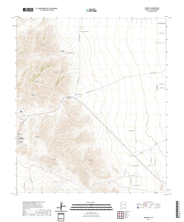
2021 Map of Bisbee NE
USGS Topo · Published 2021About this map
Bisbee and its residential suburb of Warren sit at the southern edge of this landscape, where the high peaks of the Mule Mountains descend into the surrounding desert basins. This 2021 survey traces the modern road network that navigates the complex terrain of the southern Arizona copper mining district, including Warren Cutoff Rd and S Bonanza Ave. The map highlights the drainage patterns of the region, specifically how Mule Gulch and Gold Gulch carve through the foothills between landmarks like Gold Hill and Cintura Hill. Outside the urban center, the land transitions into a grid of rural roads and canyon access points like W Mexican Canyon Rd, providing a detailed look at the interface between established mining communities and the open range of Cochise County.
Find a feature on this map
43 named features on this map. Tap any name to fly to it.
Don’t see what you’re looking for? This feature index may not catch every label — zoom into the map to look around manually.
Map Details
Editions of this 2021 Bisbee NE Map
This is the sole edition of this map. No revisions or reprints were ever made.
Other maps of this area

1902 · Bisbee
USGS Topo · 1:62,500

1910 · Bisbee
USGS Topo · 1:62,500

1914 · Douglas
USGS Topo · 1:62,500

1916 · Pearce
USGS Topo · 1:125,000

1916 · Douglas
USGS Topo · 1:125,000

1919 · Douglas
USGS Topo · 1:125,000

1922 · Swisshelm
USGS Topo · 1:62,500

1925 · Douglas
USGS Topo · 1:62,500

1925 · Gleeson
USGS Topo · 1:62,500

1927 · Bisbee
USGS Topo · 1:62,500