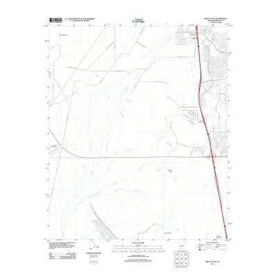
2011 Map of Biscuit Flat
USGS Topo · Published 2011About this map
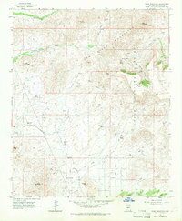
Anthem emerges as a prominent planned community in this 2011 survey, showing the rapid northward expansion of the Phoenix metropolitan area. The landscape is defined by the sharp transition between modern residential development and the surrounding desert terrain of Biscuit Flat. Water management infrastructure is a critical feature of the region, anchored by the massive Central Arizona Project CSR canal system cutting across the southern portion of the sheet. Natural drainage patterns are dominated by New River and Deadman Wash, which weave between prominent local heights such as Black Mountain, Saddle Mountain, and Mount Ochoa. Aviation and transportation hubs are clearly marked, including the Pleasant Valley Airport to the west and major transit arteries like the Desert Hills Interchange and Pioneer Interchange. The map also reveals numerous livestock tanks such as Milky Way Tank and Escondido Tank, scattered across the open desert.
Find a feature on this map
57 named features on this map. Tap any name to fly to it.
Don’t see what you’re looking for? This feature index may not catch every label — zoom into the map to look around manually.
Map Details
Editions of this 2011 Biscuit Flat Map
This is the sole edition of this map. No revisions or reprints were ever made.
Other maps of this area

1954 · Phoenix
USGS Topo · 1:250,000

1957 · Phoenix
USGS Topo · 1:250,000

1957 · Calderwood Butte
USGS Topo · 1:24,000

1957 · Hedgpeth Hills
USGS Topo · 1:24,000

1958 · Phoenix
USGS Topo · 1:250,000

1960 · Phoenix
USGS Topo · 1:250,000
1964 · New River
USGS Topo · 1:24,000
1964 · Governors Peak
USGS Topo · 1:24,000
1964 · Baldy Mtn
USGS Topo · 1:24,000
1964 · Daisy Mountain
USGS Topo · 1:24,000