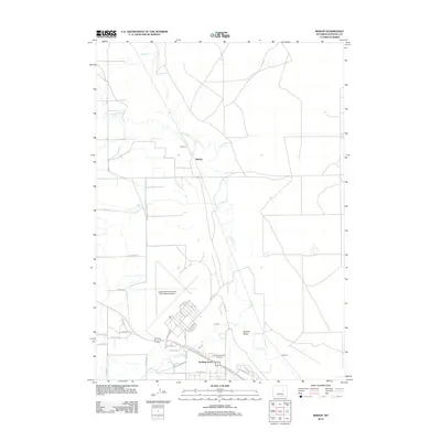
2012 Map of Bishop
USGS Topo · Published 2012About this map
Casper/Natrona County International Airport dominates the southern landscape of this region, a site defined by its strategic transportation and military heritage. The area reveals a mix of early 21st-century residential clusters and infrastructure, including the communities of Bishop, Cadoma, and Sullivan. In the southern portion of the sheet, Air Base Acres sits adjacent to the Old Yellowstone Hwy, reflecting the area's development around the airfield and major transit corridors. The terrain is marked by the meandering paths of Casper Cr and the S Fork Casper Cr, which cut through the high plains north of the airport. For genealogists and local historians, the Natrona Memorial Gardens serves as a significant landmark near the residential developments along 9 Mile Rd and N 8 Mile Rd, while Sixmile Draw defines the natural drainage to the east.
Find a feature on this map
43 named features on this map. Tap any name to fly to it.
Don’t see what you’re looking for? This feature index may not catch every label — zoom into the map to look around manually.
Map Details
Editions of this 2012 Bishop Map
This is the sole edition of this map. No revisions or reprints were ever made.
Other maps of this area

1950 · Emigrant Gap
USGS Topo · 1:24,000

1950 · Goose Egg
USGS Topo · 1:24,000

1950 · Emigrant Gap NE
USGS Topo · 1:24,000

1951 · The Reefs
USGS Topo · 1:24,000

1951 · Casper
USGS Topo · 1:24,000

1952 · Bishop
USGS Topo · 1:24,000

1955 · Arminto
USGS Topo · 1:250,000

1955 · Casper
USGS Topo · 1:250,000

1958 · Casper
USGS Topo · 1:250,000

1958 · Arminto
USGS Topo · 1:250,000