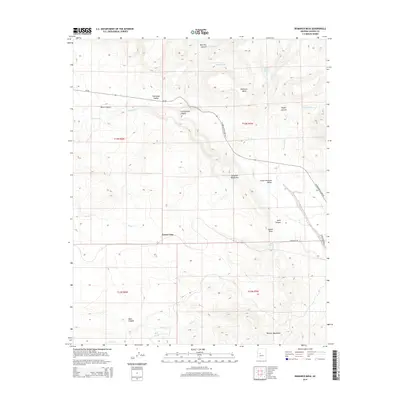
2014 Map of Bismarck Mesa
USGS Topo · Published 2014About this map
Grand View stands at the center of this map, overlooking a landscape defined by the transition between the Kendrick Mountains and the Weaver Mountains in Arizona. The terrain is marked by significant topographical variation, from the flat expanse of Bismarck Mesa to the drainage networks of Kirkland Cr and its tributaries like Moonville Cr and Ash Cr. This 2014 survey documents the remote road network of Az-96 and W Kirkland-Hillside Rd as they navigate the ridges and canyons. The presence of several water sources, including Red Bank Spring, Bells Spring, and Upper Cook Spring, indicates the vital importance of natural springs for ranching and settlement in this arid environment. Traces of local travel are preserved in the Founders Trl, while landmarks such as Squaw Peak and Black Canyon provide distinct navigational points within the complex canyon systems of Lower Kirkland Valley.
Find a feature on this map
30 named features on this map. Tap any name to fly to it.
Don’t see what you’re looking for? This feature index may not catch every label — zoom into the map to look around manually.
Map Details
Editions of this 2014 Bismarck Mesa Map
This is the sole edition of this map. No revisions or reprints were ever made.
Other maps of this area

1887 · Prescott
USGS Topo · 1:250,000

1892 · Prescott
USGS Topo · 1:250,000

1903 · Congress
USGS Topo · 1:125,000

1904 · Congress
USGS Topo · 1:125,000

1947 · Iron Springs
USGS Topo · 1:62,500

1947 · Kirkland
USGS Topo · 1:62,500

1947 · Sheridan Mountain
USGS Topo · 1:62,500

1948 · Sheridan Mountain
USGS Topo · 1:63,360

1948 · Iron Springs
USGS Topo · 1:63,360

1948 · Kirkland
USGS Topo · 1:63,360