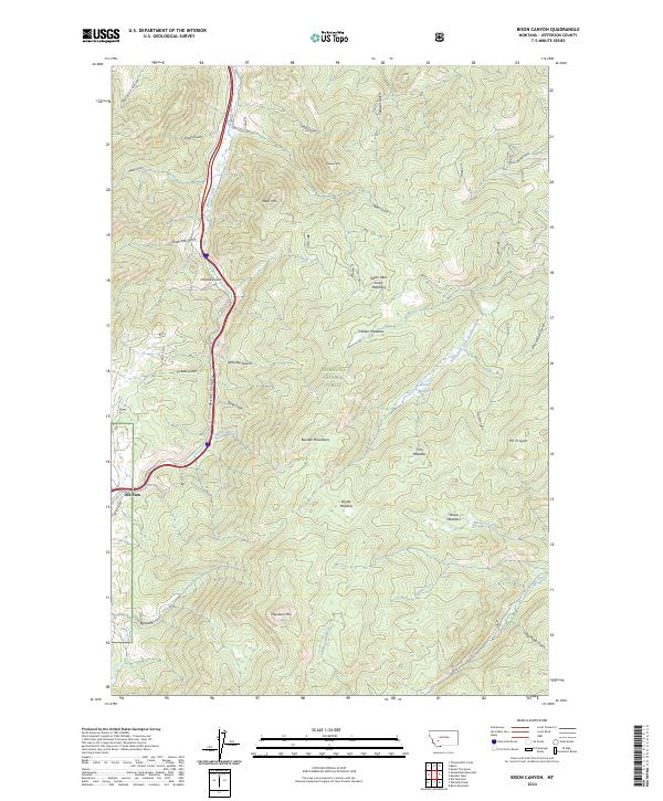
2024 Map of Bison Canyon
USGS Topo · Published 2024About this map
Deerlodge National Forest encompasses the vast majority of this landscape, dominated by the high peaks of the Boulder Mountains and the winding corridor of Bison Canyon. The settlement of Elk Park sits at the southwestern edge of the map, serving as a primary point of human activity along the mountain base. The terrain is defined by its complex drainage network, where Bison Creek and the Little Boulder River collect water from dozens of named gulches, such as Whiskey Gulch and Sawmill Creek.
Find a feature on this map
43 named features on this map. Tap any name to fly to it.
Don’t see what you’re looking for? This feature index may not catch every label — zoom into the map to look around manually.
Map Details
Editions of this 2024 Bison Canyon Map
This is the sole edition of this map. No revisions or reprints were ever made.
Other maps of this area

1889 · Helena
USGS Topo · 1:250,000

1893 · Helena
USGS Topo · 1:250,000

1899 · Boulder
USGS Topo · 1:125,000

1899 · Helena
USGS Topo · 1:250,000

1903 · Helena
USGS Topo · 1:250,000

1947 · Butte
USGS Topo · 1:250,000

1950 · Jefferson City
USGS Topo · 1:62,500

1954 · Elk Park
USGS Topo · 1:62,500

1954 · Basin
USGS Topo · 1:62,500

1954 · Boulder
USGS Topo · 1:62,500