
2013 Map of Bitter Creek
USGS Topo · Published 2013About this map
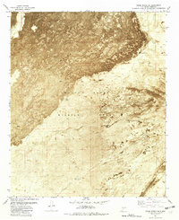
Tularosa Valley defines this arid landscape in Otero County, where the desert floor is marked by intermittent water sources and expansive terrain features. The western portion of the map is dominated by The Sands, a distinctive geographic formation near the course of Three Rivers. This 2013 survey illustrates the land's transition between natural washes like Temporal Cr and specialized infrastructure such as WSMR S Route 318 and WSMR S Route 322, which reflect the region's managed and restricted status. Strategic water points, including Rock Tank and Black Tank, appear as vital landmarks in an otherwise sparsely populated area. The grid-like survey lines highlight the vastness of the public land system, providing a clear view of the topography before these seasonal waterways reach the lower basin.
Find a feature on this map
17 named features on this map. Tap any name to fly to it.
Don’t see what you’re looking for? This feature index may not catch every label — zoom into the map to look around manually.
Map Details
Editions of this 2013 Bitter Creek Map
This is the sole edition of this map. No revisions or reprints were ever made.
Other maps of this area

1916 · Tularosa
USGS Topo · 1:125,000

1947 · Three Rivers
USGS Topo · 1:62,500

1947 · Capitol Peak
USGS Topo · 1:62,500

1948 · Lumley Lake
USGS Topo · 1:62,500

1948 · Tularosa
USGS Topo · 1:62,500

1950 · Three Rivers
USGS Topo · 1:24,000

1954 · Tularosa
USGS Topo · 1:250,000

1958 · Tularosa
USGS Topo · 1:250,000

1981 · Tularosa
USGS Topo · 1:100,000
1981 · Three Rivers SW
USGS Topo · 1:24,000