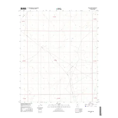
2017 Map of Bitter Creek
USGS Topo · Published 2017About this map
Three Rivers courses through this high desert landscape of Otero County, where seasonal drainage patterns and isolated water sources define the terrain. The presence of Black Tank and Rock Tank suggests the traditional ranching or military utility of this arid basin, providing critical water points for range management. The landscape is primarily organized by the Public Land Survey System, with township and range lines like t13s r8e and t12s r8e providing a grid for land navigation and property records. Movement across the valley is dictated by specialized transit routes including Wsmr P Rt 9, Wsmr S Rt 318, and Wsmr S Rt 322, which cut diagonally across the survey sections toward Temporal Cr in the south. This era of mapping shows the intersection of natural hydrology and modern infrastructure in the vicinity of the White Sands Missile Range.
Find a feature on this map
16 named features on this map. Tap any name to fly to it.
Don’t see what you’re looking for? This feature index may not catch every label — zoom into the map to look around manually.
Map Details
Editions of this 2017 Bitter Creek Map
This is the sole edition of this map. No revisions or reprints were ever made.
Other maps of this area

1916 · Tularosa
USGS Topo · 1:125,000

1947 · Three Rivers
USGS Topo · 1:62,500

1947 · Capitol Peak
USGS Topo · 1:62,500

1948 · Lumley Lake
USGS Topo · 1:62,500

1948 · Tularosa
USGS Topo · 1:62,500

1950 · Three Rivers
USGS Topo · 1:24,000

1954 · Tularosa
USGS Topo · 1:250,000

1958 · Tularosa
USGS Topo · 1:250,000

1981 · Tularosa
USGS Topo · 1:100,000
1981 · Three Rivers SW
USGS Topo · 1:24,000