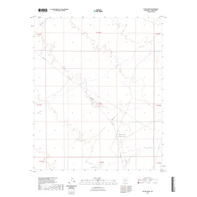
2023 Map of Bitter Creek
USGS Topo · Published 2023About this map
White Sands Missile Range dominates the eastern landscape of this Otero County corridor, reflecting the deep military footprint in the high desert. The map captures a transition between the desert floor and the drainage systems of the Sacramento Mountains, marked by the westward flow of Three Rivers and Temporal Creek. These intermittent waterways provide a window into the natural hydrology of the Tularosa Basin, while the strictly regulated road network, including WSMR P Rt 9 and WSMR 5 Rt 322, illustrates the intersection of modern defense infrastructure with the traditional Public Land Survey System grids. This 2023 survey serves as a precise record of these government-managed lands, where the landscape is defined more by restricted boundaries and natural drainage than by civilian settlement.
Find a feature on this map
15 named features on this map. Tap any name to fly to it.
Don’t see what you’re looking for? This feature index may not catch every label — zoom into the map to look around manually.
Map Details
Editions of this 2023 Bitter Creek Map
This is the sole edition of this map. No revisions or reprints were ever made.
Other maps of this area

1916 · Tularosa
USGS Topo · 1:125,000

1947 · Three Rivers
USGS Topo · 1:62,500

1947 · Capitol Peak
USGS Topo · 1:62,500

1948 · Lumley Lake
USGS Topo · 1:62,500

1948 · Tularosa
USGS Topo · 1:62,500

1950 · Three Rivers
USGS Topo · 1:24,000

1954 · Tularosa
USGS Topo · 1:250,000

1958 · Tularosa
USGS Topo · 1:250,000

1981 · Tularosa
USGS Topo · 1:100,000
1981 · Three Rivers SW
USGS Topo · 1:24,000