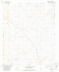
1981 Map of Bitter Creek
USGS Topo · Published 1982About this map
The White Sands Missile Range occupies the central portion of this landscape, reflecting the heavy military footprint in this region of New Mexico during the late twentieth century. Located in Otero County, the terrain is characterized by intermittent water features and isolated outposts. The ephemeral waters of Bitter Creek and Three Rivers cross the dry flats, leading toward the Bitter Spring in the southern section of the map. Traces of human activity are sparse, marked by the Rita Site and Cowan Site, alongside a network of Jeep Trails and essential water points like Rock Tank and a lone Well. This survey, field checked in the mid-1970s, documents the intersection of vast federal defense lands with the essential water infrastructure required for survival in the high desert.
Find a feature on this map
10 named features on this map. Tap any name to fly to it.
Don’t see what you’re looking for? This feature index may not catch every label — zoom into the map to look around manually.
Map Details
Editions of this 1981 Bitter Creek Map
This is the sole edition of this map. No revisions or reprints were ever made.
Other maps of this area

1916 · Tularosa
USGS Topo · 1:125,000

1947 · Three Rivers
USGS Topo · 1:62,500

1947 · Capitol Peak
USGS Topo · 1:62,500

1948 · Lumley Lake
USGS Topo · 1:62,500

1948 · Tularosa
USGS Topo · 1:62,500

1950 · Three Rivers
USGS Topo · 1:24,000

1954 · Tularosa
USGS Topo · 1:250,000

1958 · Tularosa
USGS Topo · 1:250,000

1981 · Tularosa
USGS Topo · 1:100,000
1981 · Three Rivers SW
USGS Topo · 1:24,000