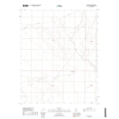
2018 Map of Bitter Spring
USGS Topo · Published 2018About this map
Bitter Spring provides a vital focal point in this 2018 survey of the arid Mojave Desert. The landscape is defined by the ephemeral drainage patterns and varying elevations of the northern desert floor, where isolated water sources like the spring served as critical waypoints for early travel and survival. The mapping detail highlights the Public Land Survey System grid across T13N R5E and surrounding townships, intersected by remote desert routes such as Red Pass Lake Rd and Langford Lake Rd. These tracks follow the natural contours of the terrain, illustrating how modern access continues to rely on the ancient geography of the basin. The map serves as a precise guide for those studying the hydrology and transportation history of this sparsely populated section of San Bernardino County.
Find a feature on this map
8 named features on this map. Tap any name to fly to it.
Don’t see what you’re looking for? This feature index may not catch every label — zoom into the map to look around manually.
Map Details
Editions of this 2018 Bitter Spring Map
This is the sole edition of this map. No revisions or reprints were ever made.
Other maps of this area

1933 · Avawatz Mountains
USGS Topo · 1:250,000

1947 · Trona
USGS Topo · 1:250,000

1948 · Red Pass Lake
USGS Topo · 1:62,500

1948 · Trona
USGS Topo · 1:250,000

1948 · Alvord Mountain
USGS Topo · 1:62,500

1948 · Cave Mountain
USGS Topo · 1:62,500

1948 · Tiefort Mountains
USGS Topo · 1:62,500

1951 · Tiefort Mountains
USGS Topo · 1:62,500

1951 · Cave Mountain
USGS Topo · 1:62,500

1951 · Alvord Mountain
USGS Topo · 1:62,500