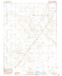
1986 Map of Bitter Spring
USGS Topo · Published 1986About this map
Bitter Spring serves as a critical desert water source within the expansive high-desert terrain of the Fort Irwin Military Reservation. This 1986 survey reflects the landscape during a period of significant military activity, where topographic contours define the basin-and-range geography. The map reveals the infrastructure required for such a remote installation, specifically the heavy Trans Lines that cut diagonally across the desert floor. These corridors of movement and resource management highlight the functional nature of the Mojave landscape during the late twentieth century, showing the intersection of natural springs and modern military utility. The area is marked by a complex network of benchmarks and elevation points, which were essential for mapping and tactical operations in San Bernardino County.
Find a feature on this map
5 named features on this map. Tap any name to fly to it.
Don’t see what you’re looking for? This feature index may not catch every label — zoom into the map to look around manually.
Map Details
Editions of this 1986 Bitter Spring Map
This is the sole edition of this map. No revisions or reprints were ever made.
Other maps of this area

1933 · Avawatz Mountains
USGS Topo · 1:250,000

1947 · Trona
USGS Topo · 1:250,000

1948 · Red Pass Lake
USGS Topo · 1:62,500

1948 · Trona
USGS Topo · 1:250,000

1948 · Alvord Mountain
USGS Topo · 1:62,500

1948 · Cave Mountain
USGS Topo · 1:62,500

1948 · Tiefort Mountains
USGS Topo · 1:62,500

1951 · Tiefort Mountains
USGS Topo · 1:62,500

1951 · Cave Mountain
USGS Topo · 1:62,500

1951 · Alvord Mountain
USGS Topo · 1:62,500