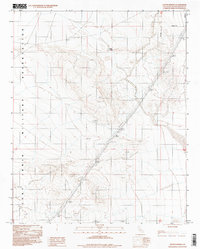
1996 Map of Bitter Spring
USGS Topo · Published 1998About this map
Fort Irwin Military Reservation dominates this desert landscape in San Bernardino County, where the high desert terrain is defined by wide alluvial fans and isolated springs. The presence of Bitter Spring near the northern edge of the map serves as a vital water source in an otherwise arid environment, typical of the remote corridors utilized for military training and scientific study. While the area lacks traditional settlements, the network of Trans Lines cutting through the southeast indicates the infrastructure required to support operations in this vast territory. This 1996 provisional map represents the region's character during a period of ongoing military use, highlighting how vital water points like Bitter Spring dictated movement through the Mojave Desert long before modern boundaries were established.
Find a feature on this map
6 named features on this map. Tap any name to fly to it.
Don’t see what you’re looking for? This feature index may not catch every label — zoom into the map to look around manually.
Map Details
Editions of this 1996 Bitter Spring Map
This is the sole edition of this map. No revisions or reprints were ever made.
Other maps of this area

1933 · Avawatz Mountains
USGS Topo · 1:250,000

1947 · Trona
USGS Topo · 1:250,000

1948 · Red Pass Lake
USGS Topo · 1:62,500

1948 · Trona
USGS Topo · 1:250,000

1948 · Alvord Mountain
USGS Topo · 1:62,500

1948 · Cave Mountain
USGS Topo · 1:62,500

1948 · Tiefort Mountains
USGS Topo · 1:62,500

1951 · Tiefort Mountains
USGS Topo · 1:62,500

1951 · Cave Mountain
USGS Topo · 1:62,500

1951 · Alvord Mountain
USGS Topo · 1:62,500