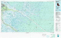
1983 Map of Black Bay
USGS Topo · Published 1983About this map
New Orleans sits at the northwestern edge of this expansive coastal survey, where the concentrated development of Chalmette and St Claude Heights transitions into the fragile wetlands of the Mississippi Delta. The Mississippi River defines the western corridor, flanked by established settlements like Belle Chasse and Braithwaite. To the east, the landscape dissolves into a complex network of bays and sounds, including Chandeleur Sound and Breton Sound. This environment is punctuated by isolated fishing and trapping communities such as Shell Beach, Hopedale, and Delacroix.
Find a feature on this map
163 named features on this map. Tap any name to fly to it.
Don’t see what you’re looking for? This feature index may not catch every label — zoom into the map to look around manually.
Map Details
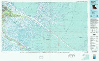
Editions of this 1983 Black Bay Map
2 editions found
Other maps of this area

1891 · Spanish Fort
USGS Topo · 1:62,500

1891 · Pointe a La Hache
USGS Topo · 1:62,500

1891 · New Orleans
USGS Topo · 1:62,500

1892 · Barataria
USGS Topo · 1:62,500

1892 · Chef Menteur
USGS Topo · 1:62,500

1892 · Quarantine
USGS Topo · 1:62,500

1892 · Creole
USGS Topo · 1:62,500

1892 · St. Bernard
USGS Topo · 1:62,500

1892 · Pointe a La Hache
USGS Topo · 1:62,500

1893 · Cat Island
USGS Topo · 1:62,500