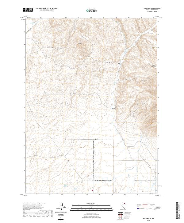
2021 Map of Black Butte
USGS Topo · Published 2021About this map
Black Butte serves as the central landmark in this high-desert portion of Elko County, where the northern reaches of the Snake Mountains dominate the eastern horizon. The landscape is defined by a series of intermittent and perennial water sources critical to the region's ranching and transit history, including Antelope Springs and West Antelope Spring. Drainage patterns across the terrain are traced by Pole Cr, Burnt Cr, and the headwaters of Trout Cr, which carve through the elevations of the T39N and T40N townships.
Find a feature on this map
15 named features on this map. Tap any name to fly to it.
Don’t see what you’re looking for? This feature index may not catch every label — zoom into the map to look around manually.
Map Details
Editions of this 2021 Black Butte Map
This is the sole edition of this map. No revisions or reprints were ever made.
Other maps of this area

1955 · Wells
USGS Topo · 1:250,000

1958 · Wells
USGS Topo · 1:250,000

1961 · Wells
USGS Topo · 1:250,000

1967 · Black Butte SW
USGS Topo · 1:24,000

1967 · Black Butte
USGS Topo · 1:24,000

1967 · Buena Vista Ranch
USGS Topo · 1:24,000

1967 · Black Butte NE
USGS Topo · 1:24,000

1967 · Metropolis
USGS Topo · 1:24,000
1967 · Tabor Flats
USGS Topo · 1:24,000

1968 · Summer Camp
USGS Topo · 1:24,000