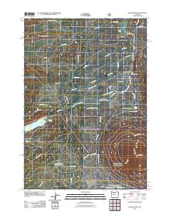
2011 Map of Black Butte
USGS Topo · Published 2011About this map
The crystalline headwaters of the Metolius River emerge near Metolius Spring, anchoring a landscape defined by resort enclaves and recreational retreats. In the early 21st century, the community of Camp Sherman remains a focal point for the region, supported by the Camp Sherman Post Office and nearby accommodations like Lake Creek Lodge and the House on the Metolius Resort. To the south, the planned community of Black Butte Ranch occupies a large basin near the base of the prominent Black Butte volcanic cone.
Find a feature on this map
45 named features on this map. Tap any name to fly to it.
Don’t see what you’re looking for? This feature index may not catch every label — zoom into the map to look around manually.
Map Details
Editions of this 2011 Black Butte Map
This is the sole edition of this map. No revisions or reprints were ever made.
Other maps of this area

1927 · Mt. Jefferson
USGS Topo · 1:125,000

1929 · Three Sisters
USGS Topo · 1:125,000

1930 · Mt. Jefferson
USGS Topo · 1:125,000

1932 · Three Sisters
USGS Topo · 1:125,000

1955 · Bend
USGS Topo · 1:250,000

1957 · Bend
USGS Topo · 1:250,000

1958 · Bend
USGS Topo · 1:250,000

1959 · Three Fingered Jack
USGS Topo · 1:62,500

1959 · Sisters
USGS Topo · 1:62,500

1961 · Whitewater River
USGS Topo · 1:62,500