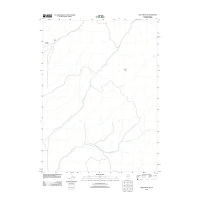
2012 Map of Black Butte NE
USGS Topo · Published 2012About this map
Urresti Ranch stands as a lonely outpost of human activity in this high-desert landscape of northeast Elko County. The terrain is defined by a series of north-flowing watercourses, including Stormy Creek, Tabor Creek, and Pole Creek, which have carved deep drainages into the high plateau. The most prominent landform is Forleen Butte, a distinctive landmark rising above the surrounding sagebrush and bunchgrass flats.
Find a feature on this map
8 named features on this map. Tap any name to fly to it.
Don’t see what you’re looking for? This feature index may not catch every label — zoom into the map to look around manually.
Map Details
Editions of this 2012 Black Butte NE Map
This is the sole edition of this map. No revisions or reprints were ever made.
Other maps of this area

1955 · Wells
USGS Topo · 1:250,000

1958 · Wells
USGS Topo · 1:250,000

1961 · Wells
USGS Topo · 1:250,000

1967 · Black Butte SW
USGS Topo · 1:24,000

1967 · Black Butte
USGS Topo · 1:24,000

1967 · Buena Vista Ranch
USGS Topo · 1:24,000

1967 · Black Butte NE
USGS Topo · 1:24,000

1968 · Summer Camp
USGS Topo · 1:24,000
1968 · Loomis Mtn
USGS Topo · 1:24,000

1968 · Hot Creek
USGS Topo · 1:24,000