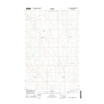
2014 Map of Black Calf Reservoir
USGS Topo · Published 2014About this map
The United States / Canada international boundary marks the northern edge of this Montana landscape, where the high plains of Valley County meet the Saskatchewan border. Drainage patterns define the local geography, specifically the southern flow of E Fork Crow Cr which feeds into the Black Calf Reservoir. This area is characterized by the distinct erosional features of the northern prairie, including two separate instances of Hardpan Coulee that cut through the undulating terrain. Transportation in this sparsely populated region is limited to a few arterial routes such as Bluff Creek Rd and Duncan Rd, which navigate the township lines of t37n r35e and t37n r36e. The map provides a clear view of the Public Land Survey System grid as it was established across this remote borderland territory.
Find a feature on this map
10 named features on this map. Tap any name to fly to it.
Don’t see what you’re looking for? This feature index may not catch every label — zoom into the map to look around manually.
Map Details
Editions of this 2014 Black Calf Reservoir Map
This is the sole edition of this map. No revisions or reprints were ever made.
Other maps of this area

1919 · Boundary
USGS Topo · 1:125,000

1954 · Glasgow
USGS Topo · 1:250,000

1957 · Glasgow
USGS Topo · 1:250,000

1958 · Glasgow
USGS Topo · 1:250,000

1984 · Snake Creek School
USGS Topo · 1:24,000

1984 · Black Calf Reservoir
USGS Topo · 1:24,000

1984 · Opheim
USGS Topo · 1:100,000

1984 · Coulter Coulee
USGS Topo · 1:24,000

1984 · Crow Creek Dam
USGS Topo · 1:24,000
1984 · Thoeny
USGS Topo · 1:24,000