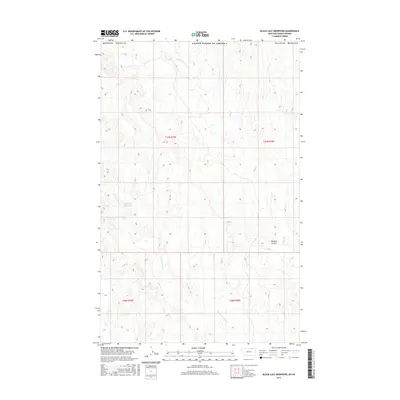
2017 Map of Black Calf Reservoir
USGS Topo · Published 2017About this map
Black Calf Reservoir sits as a central water feature in this remote section of Valley County, located along the international boundary between the United States of America and Canada. The landscape is defined by the drainage patterns of northern Montana, where intermittent waterways like Bluff Creek and Crow Creek carve through the high plains. The topography here reflects the drainage basins of the Missouri River watershed, characterized by the winding path of East Fork Crow Creek and the distinct depression of Hardpan Coulee in the southeastern quadrant. This 2017 survey details the Public Land Survey System grid across townships t37n r35e and t37n r36e, illustrating a region primarily dedicated to large-scale ranching and water management in an arid environment.
Find a feature on this map
12 named features on this map. Tap any name to fly to it.
Don’t see what you’re looking for? This feature index may not catch every label — zoom into the map to look around manually.
Map Details
Editions of this 2017 Black Calf Reservoir Map
This is the sole edition of this map. No revisions or reprints were ever made.
Other maps of this area

1919 · Boundary
USGS Topo · 1:125,000

1954 · Glasgow
USGS Topo · 1:250,000

1957 · Glasgow
USGS Topo · 1:250,000

1958 · Glasgow
USGS Topo · 1:250,000

1984 · Snake Creek School
USGS Topo · 1:24,000

1984 · Black Calf Reservoir
USGS Topo · 1:24,000

1984 · Opheim
USGS Topo · 1:100,000

1984 · Coulter Coulee
USGS Topo · 1:24,000

1984 · Crow Creek Dam
USGS Topo · 1:24,000
1984 · Thoeny
USGS Topo · 1:24,000