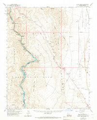
1959 Map of Black Canyon
USGS Topo · Published 1966About this map
The Colorado River carves through the heart of this landscape, separating the Black Mountains of Arizona from the Eldorado Mountains of Nevada. This mid-century survey captures the river's character before major modern alterations, highlighting a series of formidable whitewater features including Ringbolt Rapids, Cranes Nest Rapids, and Roaring Rapids. The settlement at Willow Beach serves as a focal point for activity along the water, housing a Ranger Station and the State Fish Hatchery. Away from the river corridor, the terrain transitions into the desolate beauty of Detrital Valley. The map also documents isolated industry and navigation aids such as the Two Bs Mine tucked into the Black Ridge and a Gaging Station perched above Indian Rapids, reflecting the dual priorities of mineral extraction and water management in this arid borderland.
Find a feature on this map
48 named features on this map. Tap any name to fly to it.
Don’t see what you’re looking for? This feature index may not catch every label — zoom into the map to look around manually.
Map Details
Editions of this 1959 Black Canyon Map
3 editions found
Other maps of this area

1886 · Camp Mohave
USGS Topo · 1:250,000

1886 · Saint Thomas
USGS Topo · 1:250,000

1892 · Camp Mohave
USGS Topo · 1:250,000

1893 · Saint Thomas
USGS Topo · 1:250,000

1926 · Nelson
USGS Topo · 1:96,000

1926 · Bonelli
USGS Topo · 1:96,000

1926 · Boulder Canyon
USGS Topo · 1:96,000

1942 · Camp Mohave
USGS Topo · 1:250,000

1947 · Kingman
USGS Topo · 1:250,000

1948 · Kingman
USGS Topo · 1:250,000