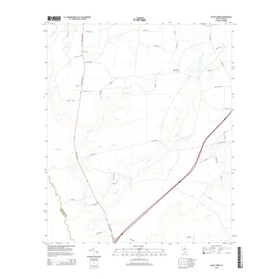
2014 Map of Black Creek
USGS Topo · Published 2014About this map
The Little Salkehatchie River and its numerous tributaries, including Sandy Run and Bull Creek, define the landscape of this rural South Carolina territory. The drainage pattern suggests a low-lying, water-dominant environment where infrastructure follows the high ground between swampy runs. Significant for local historians, the area is anchored by the Shiloh Cem and the Cane Branch Lookout Tower, landmarks that provide fixed points for genealogical and land-use research. Transportation in this part of Colleton County relies on the prominent north-south corridor of the Lowcountry Hwy, intersected by local routes like Legend Rd and Black Creek Rd. Numerous family-named roads such as Charlie Smith Ln and Aikins Ln suggest a history of multi-generational land ownership and small-scale agricultural development along the creek basins.
Find a feature on this map
41 named features on this map. Tap any name to fly to it.
Don’t see what you’re looking for? This feature index may not catch every label — zoom into the map to look around manually.
Map Details
Editions of this 2014 Black Creek Map
This is the sole edition of this map. No revisions or reprints were ever made.
Other maps of this area

1918 · Walterboro
USGS Topo · 1:62,500

1918 · Green Pond
USGS Topo · 1:62,500

1918 · Yemassee
USGS Topo · 1:62,500

1919 · Cummings
USGS Topo · 1:62,500

1943 · Yemassee
USGS Topo · 1:62,500

1943 · Green Pond
USGS Topo · 1:62,500

1943 · Cummings
USGS Topo · 1:62,500

1943 · Walterboro
USGS Topo · 1:62,500

1947 · Savannah
USGS Topo · 1:250,000

1948 · Savannah
USGS Topo · 1:250,000