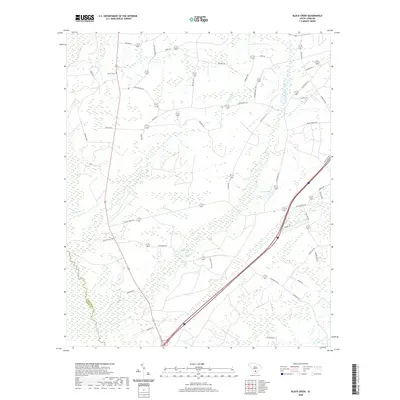
2020 Map of Black Creek
USGS Topo · Published 2020About this map
The Salkehatchie River forms a significant hydrological boundary in this portion of Colleton County, defining a landscape dominated by expansive wetlands and intricate water systems. The interior is marked by prominent water bodies such as Big Survey Lake and Crosbys Pond, which are fed by the meandering courses of Black Creek and Bull Creek. The presence of Shiloh Cem along the western edge suggests long-standing community ties to the land, while the road network reflects modern transit through the Lowcountry. Key corridors like the Low Country Hwy and Magellan Rd cut through the timbered terrain, connecting family-named landmarks like Crosby Corner Rd with the surrounding agricultural and swamp regions.
Find a feature on this map
51 named features on this map. Tap any name to fly to it.
Don’t see what you’re looking for? This feature index may not catch every label — zoom into the map to look around manually.
Map Details
Editions of this 2020 Black Creek Map
This is the sole edition of this map. No revisions or reprints were ever made.
Other maps of this area

1918 · Walterboro
USGS Topo · 1:62,500

1918 · Green Pond
USGS Topo · 1:62,500

1918 · Yemassee
USGS Topo · 1:62,500

1919 · Cummings
USGS Topo · 1:62,500

1943 · Yemassee
USGS Topo · 1:62,500

1943 · Green Pond
USGS Topo · 1:62,500

1943 · Cummings
USGS Topo · 1:62,500

1943 · Walterboro
USGS Topo · 1:62,500

1947 · Savannah
USGS Topo · 1:250,000

1948 · Savannah
USGS Topo · 1:250,000