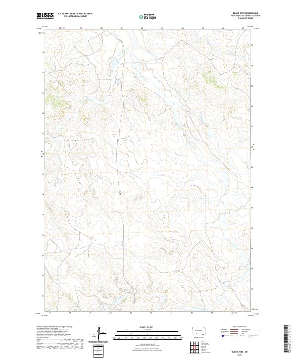
2021 Map of Black Eyes
USGS Topo · Published 2021About this map
Bear-in-the-Lodge Cr defines the drainage of this segment of Bennett County, carving a winding path through the prairie landscape alongside tributaries like Pretty Hip Cr and Red Horse Cr. This 2021 survey by the U.S. Geological Survey shows a rural landscape primarily shaped by natural hydrology and a section-line grid system. The only major named transit route is Hisle Rd, which cuts north-south across the center of the quadrangle. The map is dominated by traditional township and range divisions, specifically t39n r37w and t38n r37w, illustrating the vast, open nature of this South Dakota terrain. This modern topographic study provides an accurate record of water flow and elevation before any significant 21st-century development, focusing on the intricate creek networks like Spring Cr and Horse Cr.
Find a feature on this map
10 named features on this map. Tap any name to fly to it.
Don’t see what you’re looking for? This feature index may not catch every label — zoom into the map to look around manually.
Map Details
Editions of this 2021 Black Eyes Map
This is the sole edition of this map. No revisions or reprints were ever made.
Other maps of this area

1955 · Martin
USGS Topo · 1:250,000

1958 · Martin
USGS Topo · 1:250,000

1981 · Patricia
USGS Topo · 1:25,000

1981 · Martin
USGS Topo · 1:25,000

1981 · Allen
USGS Topo · 1:25,000

1981 · Hisle
USGS Topo · 1:25,000

1981 · Swett
USGS Topo · 1:25,000
1981 · Buzzard Butte
USGS Topo · 1:25,000

1983 · Martin
USGS Topo · 1:100,000
2012 · Horse Creek
USGS Topo · 1:24,000