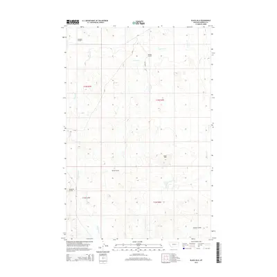
2014 Map of Black Hills
USGS Topo · Published 2014About this map
The Black Hills rise from the open rangeland of Garfield County, marking a distinctive topographic break in this part of eastern Montana. This 2014 survey reveals an intricate drainage network defined by deep-set coulees and ephemeral creek beds that have carved into the high plains. Waterways like Little Dry Cr and Lone Tree Cr flow through the northern reaches, while Cottonwood Cr and W Fork Lone Tree Cr snake across the southern half, illustrating the seasonal hydrologic patterns typical of this semi-arid landscape. The terrain is further characterized by named landforms such as Knudson Coulee and Jacques Coulee, which serve as critical landmarks for local navigation. The sparse human footprint is limited to rural routes like Williams Rd and CR-202, highlighting the ranching and livestock heritage that persists in this remote section of the Big Sky State.
Find a feature on this map
15 named features on this map. Tap any name to fly to it.
Don’t see what you’re looking for? This feature index may not catch every label — zoom into the map to look around manually.
Map Details
Editions of this 2014 Black Hills Map
This is the sole edition of this map. No revisions or reprints were ever made.
Other maps of this area

1954 · Jordan
USGS Topo · 1:250,000

1954 · Forsyth
USGS Topo · 1:250,000

1956 · Jordan
USGS Topo · 1:250,000

1957 · Forsyth
USGS Topo · 1:250,000

1958 · Jordan
USGS Topo · 1:250,000

1958 · Forsyth
USGS Topo · 1:250,000

1964 · Jordan
USGS Topo · 1:250,000

1965 · Black Hills
USGS Topo · 1:24,000

1965 · Needle Butte Reservoir
USGS Topo · 1:24,000

1965 · Needle Butte
USGS Topo · 1:24,000