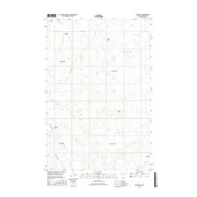
2017 Map of Black Hills
USGS Topo · Published 2017About this map
Black Hills dominates the topography of this eastern Montana landscape, where the high prairie is deeply incised by a series of coulees and ephemeral creek beds. The drainage pattern is defined by the northward flow of Little Dry Cr and Lone Tree Cr, while the southwestern portion is marked by the distinctively eroded Badlands Coulee. This 2017 survey reflects a largely undeveloped ranching environment, structured by the Public Land Survey System grid and remote thoroughfares such as Garfield Co Road 216. The land is characterized by name-bearing topographical features like Jacques Coulee and Spring Coulee, which serve as primary landmarks in a region defined by its water-carved geography rather than dense human settlement. It provides a contemporary view of Garfield County’s interior before these cattle-country tracts were further subdivided or altered.
Find a feature on this map
16 named features on this map. Tap any name to fly to it.
Don’t see what you’re looking for? This feature index may not catch every label — zoom into the map to look around manually.
Map Details
Editions of this 2017 Black Hills Map
This is the sole edition of this map. No revisions or reprints were ever made.
Other maps of this area

1954 · Jordan
USGS Topo · 1:250,000

1954 · Forsyth
USGS Topo · 1:250,000

1956 · Jordan
USGS Topo · 1:250,000

1957 · Forsyth
USGS Topo · 1:250,000

1958 · Jordan
USGS Topo · 1:250,000

1958 · Forsyth
USGS Topo · 1:250,000

1964 · Jordan
USGS Topo · 1:250,000

1965 · Black Hills
USGS Topo · 1:24,000

1965 · Needle Butte Reservoir
USGS Topo · 1:24,000

1965 · Needle Butte
USGS Topo · 1:24,000