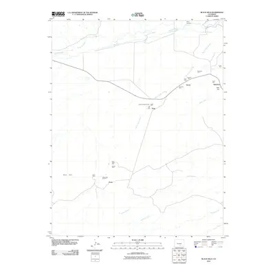
2010 Map of Black Hills
USGS Topo · Published 2010About this map
Turner Mine and the Sunnyside Mine dot the landscape of Huerfano County, revealing a region deeply tied to its industrial past. This 2010 survey shows the area around the Black Hills, where the settlement of Alamo and the Major Ranch sit near the Alamo Mine Number 1. The map documents a complex irrigation and water management network, including the Dan Mahan Ditch, Martin Ditch Number 2, and Pino Ditch, which redirect flow from the Huerfano River to support the high plains environment.
Find a feature on this map
28 named features on this map. Tap any name to fly to it.
Don’t see what you’re looking for? This feature index may not catch every label — zoom into the map to look around manually.
Map Details
Editions of this 2010 Black Hills Map
This is the sole edition of this map. No revisions or reprints were ever made.
Other maps of this area

1889 · Huerfano Park
USGS Topo · 1:125,000

1891 · Walsenburg
USGS Topo · 1:125,000

1892 · Huerfano Park
USGS Topo · 1:125,000

1894 · Walsenburg
USGS Topo · 1:125,000

1897 · Walsenburg
USGS Topo · 1:125,000

1900 · Walsenburg
USGS Topo · 1:125,000

1954 · Trinidad
USGS Topo · 1:250,000

1955 · Trinidad
USGS Topo · 1:250,000

1958 · Trinidad
USGS Topo · 1:250,000

1959 · Trinidad
USGS Topo · 1:250,000