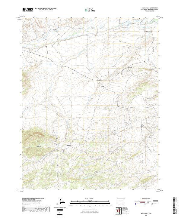
2022 Map of Black Hills
USGS Topo · Published 2022About this map
Strong, Delcarbon, and Tioga sit along the high drainage of the Huerfano River in this high-desert portion of Huerfano County. The landscape is defined by its water management and complex drainage systems, featuring various arroyos and man-made infrastructure like Pino Ditch and Martin Ditch Number 2. This network reflects the necessities of ranching and early industrial settlements in southern Colorado. The southern portion of the sheet is dominated by the Black Hills terrain, while the eastern edge is marked by the distinct passage at Bells Gap. Farther south, the settlement of Alamo is positioned near the Gordon Arroyo, providing a clear view of the area's transition from river valley to upland hills during the early twenty-first century.
Find a feature on this map
37 named features on this map. Tap any name to fly to it.
Don’t see what you’re looking for? This feature index may not catch every label — zoom into the map to look around manually.
Map Details
Editions of this 2022 Black Hills Map
This is the sole edition of this map. No revisions or reprints were ever made.
Other maps of this area

1889 · Huerfano Park
USGS Topo · 1:125,000

1891 · Walsenburg
USGS Topo · 1:125,000

1892 · Huerfano Park
USGS Topo · 1:125,000

1894 · Walsenburg
USGS Topo · 1:125,000

1897 · Walsenburg
USGS Topo · 1:125,000

1900 · Walsenburg
USGS Topo · 1:125,000

1954 · Trinidad
USGS Topo · 1:250,000

1955 · Trinidad
USGS Topo · 1:250,000

1958 · Trinidad
USGS Topo · 1:250,000

1959 · Trinidad
USGS Topo · 1:250,000