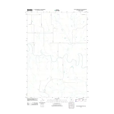
2012 Map of Black Horse Butte NE
USGS Topo · Published 2012About this map
The Grand River meanders across this rural expanse of Corson County, shaping the geography of the Rock Creek District during the early twenty-first century. This landscape is defined by the winding paths of Willow Cr in the north and Black Horse Butte Cr in the southeast, which cut through the open prairie. The grid of section lines and gravel roads, including Co Rd and 212th Ave, reveals the methodical surveying of the northern plains. Near the northern boundary, Morristown Rd provides a primary east-west artery through a region characterized by its hydrological features and wide-open spacing. Researchers can trace the drainage patterns and historical land divisions that have remained largely unchanged in this section of South Dakota for decades.
Find a feature on this map
14 named features on this map. Tap any name to fly to it.
Don’t see what you’re looking for? This feature index may not catch every label — zoom into the map to look around manually.
Map Details
Editions of this 2012 Black Horse Butte NE Map
This is the sole edition of this map. No revisions or reprints were ever made.
Other maps of this area

1953 · McIntosh
USGS Topo · 1:250,000

1956 · Cottonwood Creek NW
USGS Topo · 1:24,000

1956 · Cottonwood Creek SW
USGS Topo · 1:24,000

1958 · McIntosh
USGS Topo · 1:250,000

1972 · Black Horse Butte NW
USGS Topo · 1:24,000

1972 · Black Horse Butte
USGS Topo · 1:24,000

1972 · Skull Butte
USGS Topo · 1:24,000

1972 · Thunder Hawk SW
USGS Topo · 1:24,000

1972 · Thunder Hawk SE
USGS Topo · 1:24,000

1972 · Twin Butte
USGS Topo · 1:24,000