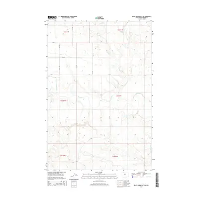
2015 Map of Black Horse Butte NE
USGS Topo · Published 2015About this map
Grand River meanders across this northern South Dakota landscape, carving a wide valley through the plains of Corson County. The terrain is defined by the drainage systems of Willow Cr and Black Horse Butte Cr, which feed into the primary river channel. This map illustrates the intersection of several townships, including t20n r19e and t21n r19e, showing the section-line grid that governs the region's land division. A network of rural section roads, such as 114th St and Co Rd, provides access across the open country, while the contour lines reveal the subtle but complex elevations leading toward the namesake butte features of the surrounding territory.
Find a feature on this map
15 named features on this map. Tap any name to fly to it.
Don’t see what you’re looking for? This feature index may not catch every label — zoom into the map to look around manually.
Map Details
Editions of this 2015 Black Horse Butte NE Map
This is the sole edition of this map. No revisions or reprints were ever made.
Other maps of this area

1953 · McIntosh
USGS Topo · 1:250,000

1956 · Cottonwood Creek NW
USGS Topo · 1:24,000

1956 · Cottonwood Creek SW
USGS Topo · 1:24,000

1958 · McIntosh
USGS Topo · 1:250,000

1972 · Black Horse Butte NW
USGS Topo · 1:24,000

1972 · Black Horse Butte
USGS Topo · 1:24,000

1972 · Skull Butte
USGS Topo · 1:24,000

1972 · Thunder Hawk SW
USGS Topo · 1:24,000

1972 · Thunder Hawk SE
USGS Topo · 1:24,000

1972 · Twin Butte
USGS Topo · 1:24,000