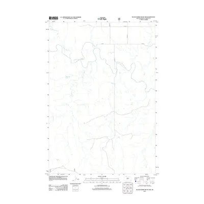
2012 Map of Black Horse Butte NW
USGS Topo · Published 2012About this map
Grand River meanders across this northern South Dakota landscape, defining the local hydrology alongside several significant tributaries. In the early 21st century, the terrain is characterized by a sparse network of section-line roads, including 114th St and 209th Ave, which carve through the open country of the Rock Creek District. The drainage patterns of Thunder Hawk Cr and Cyclone Cr reveal the intricate erosion of the prairie, while the presence of Cottonwood Cr and Deer Cr underscores the importance of seasonal watercourses in this semi-arid region of Corson County.
Find a feature on this map
11 named features on this map. Tap any name to fly to it.
Don’t see what you’re looking for? This feature index may not catch every label — zoom into the map to look around manually.
Map Details
Editions of this 2012 Black Horse Butte NW Map
This is the sole edition of this map. No revisions or reprints were ever made.
Other maps of this area

1953 · McIntosh
USGS Topo · 1:250,000

1954 · Lemmon
USGS Topo · 1:250,000

1957 · Lemmon
USGS Topo · 1:250,000

1958 · McIntosh
USGS Topo · 1:250,000

1972 · Black Horse Butte NW
USGS Topo · 1:24,000

1972 · Black Horse Butte
USGS Topo · 1:24,000

1972 · Thunder Hawk SW
USGS Topo · 1:24,000

1972 · Thunder Hawk SE
USGS Topo · 1:24,000

1972 · Twin Butte
USGS Topo · 1:24,000

1972 · Black Horse Butte NE
USGS Topo · 1:24,000