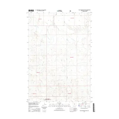
2015 Map of Black Horse Butte NW
USGS Topo · Published 2015About this map
Grand River National Grassland dominates the landscape in this section of Corson County, where the wide valley of the Grand River carves through the plains. The terrain is defined by a dendritic network of drainages, including Thunder Hawk Creek and Cyclone Creek in the north, and the winding path of Cottonwood Creek to the southwest. This 2015 survey illustrates the enduring Public Land Survey System grid that organizes the South Dakota prairie, with section lines marked by rural routes such as 114th St and 208th Ave. The map captures the open, sparsely settled character of the Rock Creek District, where the land use is primarily governed by the national grassland designation, preserving a landscape largely unchanged by modern development.
Find a feature on this map
20 named features on this map. Tap any name to fly to it.
Don’t see what you’re looking for? This feature index may not catch every label — zoom into the map to look around manually.
Map Details
Editions of this 2015 Black Horse Butte NW Map
This is the sole edition of this map. No revisions or reprints were ever made.
Other maps of this area

1953 · McIntosh
USGS Topo · 1:250,000

1954 · Lemmon
USGS Topo · 1:250,000

1957 · Lemmon
USGS Topo · 1:250,000

1958 · McIntosh
USGS Topo · 1:250,000

1972 · Black Horse Butte NW
USGS Topo · 1:24,000

1972 · Black Horse Butte
USGS Topo · 1:24,000

1972 · Thunder Hawk SW
USGS Topo · 1:24,000

1972 · Thunder Hawk SE
USGS Topo · 1:24,000

1972 · Twin Butte
USGS Topo · 1:24,000

1972 · Black Horse Butte NE
USGS Topo · 1:24,000