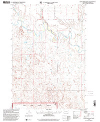
1998 Map of Black Horse Butte NW
USGS Topo · Published 2001About this map
The Grand River meanders across this northern South Dakota landscape, defining the wide Grand Valley as it flows through the Grand River National Grassland. This 1990s revision captures a region characterized by sparse ranching operations and vast open terrain, with the T Lyman Ranch serving as a primary named landmark along the river's path. The landscape is segmented by significant survey lines, including the Fifth Standard Parallel North and the border between Perkins and Corson Counties.
Find a feature on this map
12 named features on this map. Tap any name to fly to it.
Don’t see what you’re looking for? This feature index may not catch every label — zoom into the map to look around manually.
Map Details
Editions of this 1998 Black Horse Butte NW Map
This is the sole edition of this map. No revisions or reprints were ever made.
Other maps of this area

1953 · McIntosh
USGS Topo · 1:250,000

1954 · Lemmon
USGS Topo · 1:250,000

1957 · Lemmon
USGS Topo · 1:250,000

1958 · McIntosh
USGS Topo · 1:250,000

1972 · Black Horse Butte NW
USGS Topo · 1:24,000

1972 · Black Horse Butte
USGS Topo · 1:24,000

1972 · Thunder Hawk SW
USGS Topo · 1:24,000

1972 · Thunder Hawk SE
USGS Topo · 1:24,000

1972 · Twin Butte
USGS Topo · 1:24,000

1972 · Black Horse Butte NE
USGS Topo · 1:24,000