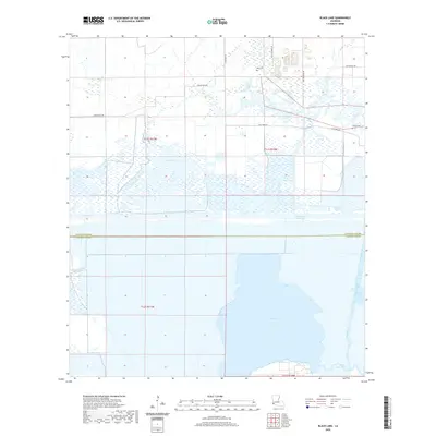
2020 Map of Black Lake
USGS Topo · Published 2020About this map
The boundary between Calcasieu Parish and Cameron Parish bisects this coastal marshland, where the waters of Black Lake dominate the southern landscape. This modern survey illustrates the complex relationship between natural hydrology and industrial engineering in the Louisiana wetlands, featuring the prominent Intracoastal Waterway cutting a straight horizontal path across the terrain. To the north, the landscape is defined by sprawling wetlands like the Clear Marais and winding waterways including Bayou Choupiqué. Local genealogy is anchored by family-named landmarks such as Moss Cem and Landry Cem, located near the roads that serve the scattered homesteads north of the marshes. The presence of the Alkali Ditch and Brown Lake in the southeast corner further suggests the specialized water management and drainage systems characteristic of the Gulf Coast's low-lying parishes.
Find a feature on this map
18 named features on this map. Tap any name to fly to it.
Don’t see what you’re looking for? This feature index may not catch every label — zoom into the map to look around manually.
Map Details
Editions of this 2020 Black Lake Map
This is the sole edition of this map. No revisions or reprints were ever made.
Other maps of this area

1932 · Moss Lake
USGS Topo · 1:31,680

1932 · Orange
USGS Topo · 1:62,500

1934 · Browns Lake
USGS Topo · 1:24,000

1934 · Five Lakes
USGS Topo · 1:24,000

1935 · Five Lakes
USGS Topo · 1:31,680

1935 · Hackberry
USGS Topo · 1:31,680

1935 · Browns Lake
USGS Topo · 1:31,680

1946 · Moss Lake
USGS Topo · 1:31,680

1947 · Sulphur
USGS Topo · 1:31,680

1947 · Vinton
USGS Topo · 1:31,680