
1935 Map of Hackberry
USGS Topo · Published 1935About this map
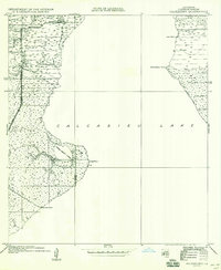
The salt marshes and waterways surrounding Calcasieu Lake dominate this mid-1930s coastal survey. The settlement of Hackberry PO serves as the primary hub in the northwest corner, where the State Highway connects the community to localized points like Rhodes. The landscape is a complex network of wetlands and drainage, characterized by numbered features like No 1 Canal and No 2 Canal that reflect early efforts to manage the water levels of the low-lying Cameron Parish terrain.
Find a feature on this map
17 named features on this map. Tap any name to fly to it.
Don’t see what you’re looking for? This feature index may not catch every label — zoom into the map to look around manually.
Map Details
Editions of this 1935 Hackberry Map
2 editions found
Other maps of this area

1932 · Moss Lake
USGS Topo · 1:31,680

1932 · Lake Charles SW
USGS Topo · 1:31,680

1934 · Cameron
USGS Topo · 1:24,000

1934 · Holly Beach
USGS Topo · 1:24,000

1934 · Sweet Lake
USGS Topo · 1:24,000

1934 · Browns Lake
USGS Topo · 1:24,000

1934 · Grand Bayou
USGS Topo · 1:24,000

1935 · Cameron
USGS Topo · 1:31,680

1935 · Sweet Lake
USGS Topo · 1:31,680

1935 · Holly Beach
USGS Topo · 1:31,680