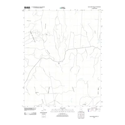
2010 Map of Black Mesa Butte
USGS Topo · Published 2010About this map
Black Mesa and its namesake Black Mesa Butte dominate this section of San Juan County, Utah, where a network of remote roads and washes cuts through the high desert floor. The landscape is punctuated by curiously named landforms like the Cheese and Raisins Hills and distinctive topographic features such as Zekes Hole and Ruin Spring Point. Evidence of local industry appears at the Ford Mine Shaft situated near the Brushy Basin Wash.
Find a feature on this map
32 named features on this map. Tap any name to fly to it.
Don’t see what you’re looking for? This feature index may not catch every label — zoom into the map to look around manually.
Map Details
Editions of this 2010 Black Mesa Butte Map
This is the sole edition of this map. No revisions or reprints were ever made.
Other maps of this area

1886 · Abajo
USGS Topo · 1:250,000

1892 · Abajo
USGS Topo · 1:250,000

1893 · Abajo
USGS Topo · 1:250,000

1935 · Elk Ridge
USGS Topo · 1:96,000

1940 · Elk Ridge
USGS Topo · 1:125,000

1954 · Elk Ridge 4 NW
USGS Topo · 1:24,000

1956 · Cortez
USGS Topo · 1:250,000
1957 · Elk Ridge 4 NE
USGS Topo · 1:24,000

1957 · Elk Ridge 4 SE
USGS Topo · 1:24,000

1957 · Brushy Basin Wash
USGS Topo · 1:62,500