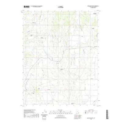
2020 Map of Black Mesa Butte
USGS Topo · Published 2020About this map
Shumway Mines sit perched among the complex topography of the high desert, representing the enduring legacy of uranium and vanadium extraction in this corner of the Colorado Plateau. The landscape south of Blanding is defined by a series of dramatic mesas and drainages, where White Mesa and the prominent Black Mesa Butte overlook a network of ephemeral watercourses including Cottonwood Wash and Westwater Cr. This 2020 map documents the modern infrastructure of the region, from the winding path of Black Mesa Rd to the various county routes that provide access to more remote locations like Zekes Hole and Brushy Basin Rim. Researchers will note the evocative names given to the terrain, such as the Cheese and Raisins Hills, which speak to the local character and history of the land's exploration and naming by residents and surveyors.
Find a feature on this map
37 named features on this map. Tap any name to fly to it.
Don’t see what you’re looking for? This feature index may not catch every label — zoom into the map to look around manually.
Map Details
Editions of this 2020 Black Mesa Butte Map
This is the sole edition of this map. No revisions or reprints were ever made.
Other maps of this area

1886 · Abajo
USGS Topo · 1:250,000

1892 · Abajo
USGS Topo · 1:250,000

1893 · Abajo
USGS Topo · 1:250,000

1935 · Elk Ridge
USGS Topo · 1:96,000

1940 · Elk Ridge
USGS Topo · 1:125,000

1954 · Elk Ridge 4 NW
USGS Topo · 1:24,000

1956 · Cortez
USGS Topo · 1:250,000
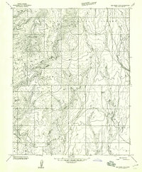
1957 · Elk Ridge 4 NE
USGS Topo · 1:24,000

1957 · Elk Ridge 4 SE
USGS Topo · 1:24,000

1957 · Brushy Basin Wash
USGS Topo · 1:62,500