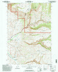
1993 Map of Black Mountain
USGS Topo · Published 1997About this map
Bighorn National Forest terrain dominates this 1993 study, where high mountain ridges are bisected by dramatic drainage systems. The Shell Canyon Scenic Byway winds through the central corridor, following the course of Shell Creek past the small settlement at Post Creek. This area serves as a focal point for both education and recreation, noted by the presence of the Iowa State Univ Geology Camp and the Trapper Lodge Ranch located further south along the Black Mountain Road.
Find a feature on this map
43 named features on this map. Tap any name to fly to it.
Don’t see what you’re looking for? This feature index may not catch every label — zoom into the map to look around manually.
Map Details
Editions of this 1993 Black Mountain Map
This is the sole edition of this map. No revisions or reprints were ever made.
Other maps of this area

1898 · Bald Mountain
USGS Topo · 1:125,000

1901 · Bald Mountain
USGS Topo · 1:125,000

1955 · Sheridan
USGS Topo · 1:250,000

1958 · Sheridan
USGS Topo · 1:250,000

1960 · Shell Falls
USGS Topo · 1:24,000

1960 · White Sulphur Spring
USGS Topo · 1:24,000

1960 · Black Mountain
USGS Topo · 1:24,000

1960 · Granite Pass
USGS Topo · 1:24,000

1960 · Manderson NE
USGS Topo · 1:24,000

1960 · Hidden Tepee Creek
USGS Topo · 1:24,000