
1960 Map of Hidden Tepee Creek
USGS Topo · Published 1962About this map
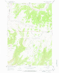
Bighorn National Forest lands dominate this high-altitude landscape where the Big Horn and Sheridan County line crosses through the peaks and canyons. The presence of the Horse Creek Cow Camp at the edge of Torry Gulch points to the seasonal grazing operations typical of this era, supported by numerous water sources such as Wolf Springs and Deer Spring. The drainage network is complex, characterized by the North Tongue River and the bifurcated West Fork Horse Creek and East Fork Horse Creek which carve between high plateaus like Elkhorn Mesa and Sunlight Mesa. Access is restricted to the Hunt Mountain Road and various Jeep Trails, highlighting the isolation of these summits before more modern developments or expanded recreational infrastructure reached the deeper forest interior.
Find a feature on this map
28 named features on this map. Tap any name to fly to it.
Don’t see what you’re looking for? This feature index may not catch every label — zoom into the map to look around manually.
Map Details
Editions of this 1960 Hidden Tepee Creek Map
2 editions found
Other maps of this area

1898 · Bald Mountain
USGS Topo · 1:125,000

1901 · Bald Mountain
USGS Topo · 1:125,000

1955 · Sheridan
USGS Topo · 1:250,000

1958 · Sheridan
USGS Topo · 1:250,000

1960 · Shell Falls
USGS Topo · 1:24,000

1960 · Black Mountain
USGS Topo · 1:24,000

1960 · Granite Pass
USGS Topo · 1:24,000

1960 · Shell
USGS Topo · 1:24,000
1960 · Bald Mountain
USGS Topo · 1:24,000
1960 · Leavitt Reservoir
USGS Topo · 1:24,000