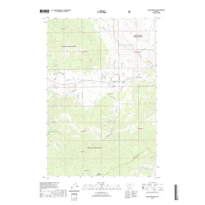
2020 Map of Black Mountain
USGS Topo · Published 2020About this map
Mta Fort Wm Henry Harrison dominates the northeastern corner of this landscape, marking a significant military presence just west of the Montana state capital. The terrain is defined by the high elevations of the Helena National Forest, where peaks like Black Mtn and Colorado Mtn overlook a complex network of drainage basins. Small-scale aviation infrastructure, including the Ten Mile Airport and Duncan Airport, is situated along the valley floor near Tenmile Creek, illustrating how the local geography dictates transportation and land use in this mountain environment.
Find a feature on this map
54 named features on this map. Tap any name to fly to it.
Don’t see what you’re looking for? This feature index may not catch every label — zoom into the map to look around manually.
Map Details
Editions of this 2020 Black Mountain Map
This is the sole edition of this map. No revisions or reprints were ever made.
Other maps of this area

1889 · Helena
USGS Topo · 1:250,000

1893 · Helena
USGS Topo · 1:250,000

1899 · Boulder
USGS Topo · 1:125,000

1899 · Helena
USGS Topo · 1:62,500

1899 · Helena
USGS Topo · 1:250,000

1903 · Helena
USGS Topo · 1:250,000

1947 · Butte
USGS Topo · 1:250,000

1950 · Jefferson City
USGS Topo · 1:62,500

1950 · Helena
USGS Topo · 1:62,500

1954 · Basin
USGS Topo · 1:62,500