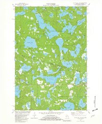
1981 Map of Black Oak Lake
USGS Topo · Published 1982About this map
Ottawa National Forest dominates the upper half of this 1981 survey, where the Michigan and Wisconsin border cuts through a dense network of glacial lakes and wetlands. The landscape is defined by its recreation and conservation history, featuring the Sylvania wilderness area and numerous Campgrounds distributed around Whitefish Lake and Clark Lake. The transition from Gogebic County, Michigan, to Vilas County, Wisconsin, is marked by a shift toward more developed access points, including a Fish Hatchery and several boat ramps.
Find a feature on this map
93 named features on this map. Tap any name to fly to it.
Don’t see what you’re looking for? This feature index may not catch every label — zoom into the map to look around manually.
Map Details
Editions of this 1981 Black Oak Lake Map
2 editions found
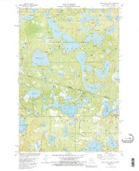
Other maps of this area

1938 · Phelps
USGS Topo · 1:48,000

1946 · Star Lake
USGS Topo · 1:48,000

1950 · Phelps
USGS Topo · 1:48,000

1950 · Star Lake
USGS Topo · 1:48,000

1952 · Watersmeet
USGS Topo · 1:62,500

1952 · Thayer
USGS Topo · 1:62,500

1955 · Starlake
USGS Topo · 1:62,500

1956 · Phelps
USGS Topo · 1:62,500

1958 · Iron River
USGS Topo · 1:250,000

1960 · Iron River
USGS Topo · 1:250,000