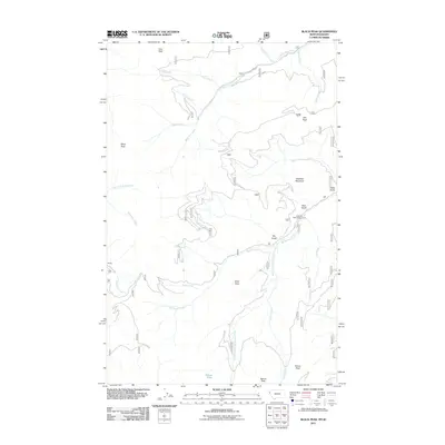
2011 Map of Black Peak
USGS Topo · Published 2011About this map
Duthie stands as the primary named settlement in this high-altitude landscape of the Idaho Panhandle, situated near the western edge of the quadrangle. The terrain is defined by a series of prominent summits including Black Peak, Dixie Peak, and Sex Peak, which overlook a complex drainage network that feeds into the Big Beaver Creek and its many tributaries. A notable transition in the landscape is visible around Beaver Lake and the South Branch Big Beaver Creek, where narrow valleys open up to provide access for local routes like Whitepine Creek Rd. The inclusion of the Jack Pine Flats Campground reflects the modern land use within these Forest Service lands, while labels such as Jew Peak and Ripper Creek preserve the vernacular names of the early mining and logging era.
Find a feature on this map
29 named features on this map. Tap any name to fly to it.
Don’t see what you’re looking for? This feature index may not catch every label — zoom into the map to look around manually.
Map Details
Editions of this 2011 Black Peak Map
This is the sole edition of this map. No revisions or reprints were ever made.
Other maps of this area

1901 · Coeur D'Alene District
USGS Topo · 1:62,500

1903 · Coeur D'Alene District
USGS Topo · 1:62,500

1906 · Coeur D'Alene District
USGS Topo · 1:62,500

1932 · Trout Creek
USGS Topo · 1:125,000

1935 · Trout Creek
USGS Topo · 1:125,000

1936 · Trout Creek
USGS Topo · 1:125,000

1956 · Cooper Gulch
USGS Topo · 1:62,500

1956 · Wallace
USGS Topo · 1:250,000

1957 · Burke
USGS Topo · 1:62,500

1960 · Wallace
USGS Topo · 1:250,000