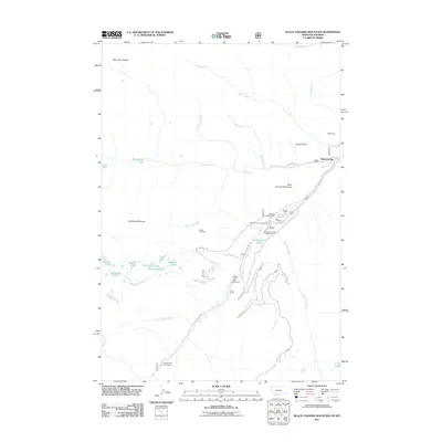
2011 Map of Black Pyramid Mountain
USGS Topo · Published 2011About this map
Richel Lodge serves as the primary outpost on this high-altitude landscape, situated where Lake Fork Rd meets the rushing waters of Rock Creek. This 2011 survey reveals an environment shaped by recreation and resource extraction, with multiple sites such as Parkside Campground and Limber Pine Campground lining the canyon floor. High above the water, the Hellroaring Plateau and Silver Run Plateau dominate the skyline, punctuated by isolated alpine features like Snowbank Lake, Hairpin Lake, and Cresent Lake. Traces of industry remain visible through the Edsel Mine near Tolman Point and the Gallon Jug Mine further south. The map documents a complex drainage network where Hellroaring Creek and Silver Falls Creek descend from the heights to join the main stem of the Rock Creek valley.
Find a feature on this map
41 named features on this map. Tap any name to fly to it.
Don’t see what you’re looking for? This feature index may not catch every label — zoom into the map to look around manually.
Map Details
Editions of this 2011 Black Pyramid Mountain Map
This is the sole edition of this map. No revisions or reprints were ever made.
Other maps of this area

1896 · Crandall Creek
USGS Topo · 1:125,000

1898 · Granite Mountain District
USGS Topo · 1:125,000

1899 · Crandall
USGS Topo · 1:125,000

1950 · Deep Lake
USGS Topo · 1:62,500

1954 · Billings
USGS Topo · 1:250,000

1955 · Cody
USGS Topo · 1:250,000

1956 · Alpine
USGS Topo · 1:62,500

1956 · Mount Maurice
USGS Topo · 1:62,500

1956 · Beartooth Butte
USGS Topo · 1:62,500

1957 · Billings
USGS Topo · 1:250,000