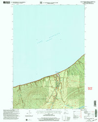
1999 Map of Black River Harbor
USGS Topo · Published 2004About this map
Lake Superior dominates the northern reaches of this coastal Michigan landscape, where the Black River carves a dramatic path toward its mouth. Within the Ottawa National Forest, the river descends through a series of significant geological drops, including Potawatomi Falls, Great Conglomerate Falls, and Manitou Falls. This late-twentieth-century survey illustrates the importance of recreation and forest management in Gogebic County, centering on the Black River Harbor Ranger Station and its surrounding infrastructure.
Find a feature on this map
26 named features on this map. Tap any name to fly to it.
Don’t see what you’re looking for? This feature index may not catch every label — zoom into the map to look around manually.
Map Details
Editions of this 1999 Black River Harbor Map
This is the sole edition of this map. No revisions or reprints were ever made.
Other maps of this area

1953 · Ashland
USGS Topo · 1:250,000

1956 · Carp River
USGS Topo · 1:62,500

1956 · North Ironwood
USGS Topo · 1:62,500

1956 · Thomaston
USGS Topo · 1:62,500

1958 · Ashland
USGS Topo · 1:250,000

1958 · Iron River
USGS Topo · 1:250,000

1960 · Iron River
USGS Topo · 1:250,000

1961 · Iron River
USGS Topo · 1:250,000

1967 · Iron River
USGS Topo · 1:250,000

1979 · Ontonagon
USGS Topo · 1:100,000