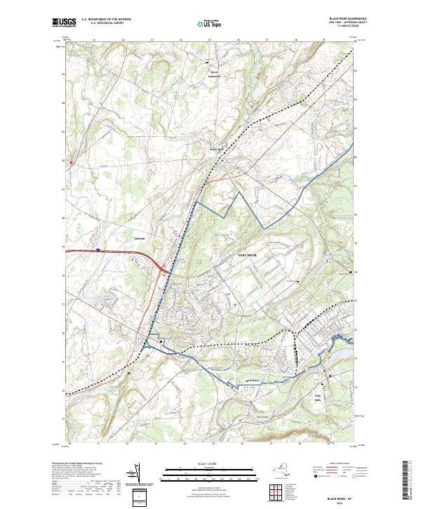
2023 Map of Black River
USGS Topo · Published 2023About this map
Fort Drum dominates the central and eastern portions of this Jefferson County landscape, where the modern military installation overlays a grid of historical roads and waterways. The community of Evans Mills sits at the junction of the Indian River and Pleasant Creek, serving as a focal point for local transit alongside the older hamlet of Dutch Settlement to the north. Further south, the map follows the path of the namesake Black River, passing the industrial footprint of Felts Mills and Poors Island. For those tracing local heritage, the area is dotted with historical markers such as Saint Marys Cem, Sanford Corners Cem, and the Quaker Cem near the military boundary. These sites, along with the residential clusters at Calcium and Black River, show the evolution of northern New York's transition from a mill-based river economy to a landscape shaped by significant national defense infrastructure.
Find a feature on this map
169 named features on this map. Tap any name to fly to it.
Don’t see what you’re looking for? This feature index may not catch every label — zoom into the map to look around manually.
Map Details
Editions of this 2023 Black River Map
This is the sole edition of this map. No revisions or reprints were ever made.
Other maps of this area

1895 · Watertown
USGS Topo · 1:62,500

1898 · Watertown
USGS Topo · 1:62,500

1902 · Carthage
USGS Topo · 1:62,500

1903 · Theresa
USGS Topo · 1:62,500

1904 · Carthage
USGS Topo · 1:62,500

1908 · Watertown
USGS Topo · 1:62,500

1909 · Watertown
USGS Topo · 1:62,500

1911 · Antwerp
USGS Topo · 1:62,500

1942 · Copenhagen
USGS Topo · 1:24,000
1943 · Watertown
USGS Topo · 1:31,680