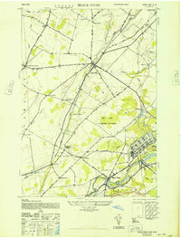
1948 Map of Black River
USGS Topo · Published 1948About this map
Pine Camp U S Military Reservation dominates the central landscape of Jefferson County in the late 1940s, a sprawling facility that fundamentally reshaped the local geography. This survey captures the rural character of the region just as military expansion began to encompass older crossroads like LeRaysville and Gould Corners. The New York Central railroad provides a vital industrial spine, connecting the limestone quarrying around Calcium to the milling operations at Felts Mills and the namesake settlement of Black River.
Find a feature on this map
43 named features on this map. Tap any name to fly to it.
Don’t see what you’re looking for? This feature index may not catch every label — zoom into the map to look around manually.
Map Details
Editions of this 1948 Black River Map
This is the sole edition of this map. No revisions or reprints were ever made.
Other maps of this area

1895 · Watertown
USGS Topo · 1:62,500

1898 · Watertown
USGS Topo · 1:62,500

1902 · Carthage
USGS Topo · 1:62,500

1903 · Theresa
USGS Topo · 1:62,500

1904 · Carthage
USGS Topo · 1:62,500

1908 · Watertown
USGS Topo · 1:62,500

1909 · Watertown
USGS Topo · 1:62,500

1911 · Antwerp
USGS Topo · 1:62,500

1942 · Copenhagen
USGS Topo · 1:24,000
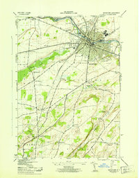
1943 · Watertown
USGS Topo · 1:31,680